Benchmark on top of SW parapet of bridge NW of Swine Gill Cottages
Introduction
The photograph on this page of Benchmark on top of SW parapet of bridge NW of Swine Gill Cottages by Luke Shaw as part of the Geograph project.
The Geograph project started in 2005 with the aim of publishing, organising and preserving representative images for every square kilometre of Great Britain, Ireland and the Isle of Man.

There are currently over 7.5m images from over 14,400 individuals and you can help contribute to the project by visiting https://www.geograph.org.uk
Benchmark on top of SW parapet of bridge NW of Swine Gill Cottages
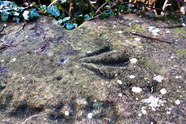
Image: © Luke Shaw Taken: 4 Feb 2020
Ordnance Survey pivot benchmark described on the Bench Mark Database at www.bench-marks.org.uk/bm115993. It appears that the coping stone with the mark has been moved from the parapet on the NE side of the road where it should be according to OS documents and maps.
Images are licensed for reuse under creativecommons.org/licenses/by-sa/2.0
Image Location
Latitude
54.653075
Longitude
-2.636042