Epworth Telephone Exchange (1)
Introduction
The photograph on this page of Epworth Telephone Exchange (1) by David Hillas as part of the Geograph project.
The Geograph project started in 2005 with the aim of publishing, organising and preserving representative images for every square kilometre of Great Britain, Ireland and the Isle of Man.

There are currently over 7.5m images from over 14,400 individuals and you can help contribute to the project by visiting https://www.geograph.org.uk
Epworth Telephone Exchange (1)
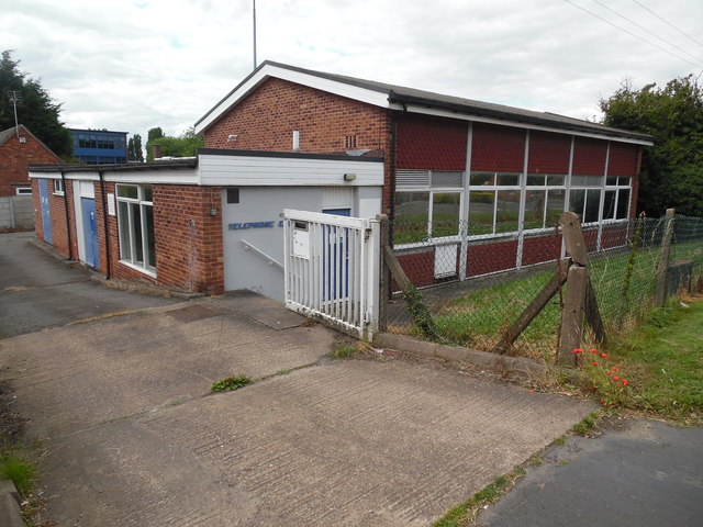
Image: © David Hillas Taken: 18 Jul 2019
Located at 26A Burnham Road (A161), this building would appear to date from the 1960s replacing a smaller TE in the same village. It has the code SLEP, and provides telephone and broadband services to 2,931 residential and 197 non-residential premises in Epworth and the surrounding area including Belton. The blue building behind the TE to the left of the photo is that of South Axholme Academy, a secondary school.
Images are licensed for reuse under creativecommons.org/licenses/by-sa/2.0
Image Location
Latitude
53.524367
Longitude
-0.824912