49 and 51 - 53 Park Lane East
Introduction
The photograph on this page of 49 and 51 - 53 Park Lane East by Ian Capper as part of the Geograph project.
The Geograph project started in 2005 with the aim of publishing, organising and preserving representative images for every square kilometre of Great Britain, Ireland and the Isle of Man.

There are currently over 7.5m images from over 14,400 individuals and you can help contribute to the project by visiting https://www.geograph.org.uk
49 and 51 - 53 Park Lane East
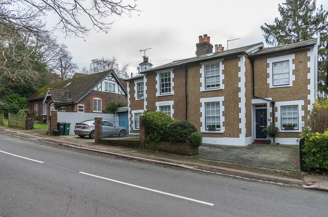
Image: © Ian Capper Taken: 10 Jan 2020
51 - 53 Park Lane East (nearest) are a pair of semi-detached houses on Park Lane East, originally an orphanage - no, 51, the further section, has the inscription "The Old Orphanage" above its front window. Beyond is no 49, a former mission hall - see Image for full background.
Images are licensed for reuse under creativecommons.org/licenses/by-sa/2.0
Image Location
Latitude
51.22746
Longitude
-0.209675