
Miles to Lichfield - Shenstone, Staffordshire
Introduction
The photograph on this page of Miles to Lichfield - Shenstone, Staffordshire by Martin Richard Phelan as part of the Geograph project.
The Geograph project started in 2005 with the aim of publishing, organising and preserving representative images for every square kilometre of Great Britain, Ireland and the Isle of Man.

There are currently over 7.5m images from over 14,400 individuals and you can help contribute to the project by visiting https://www.geograph.org.uk
Miles to Lichfield - Shenstone, Staffordshire
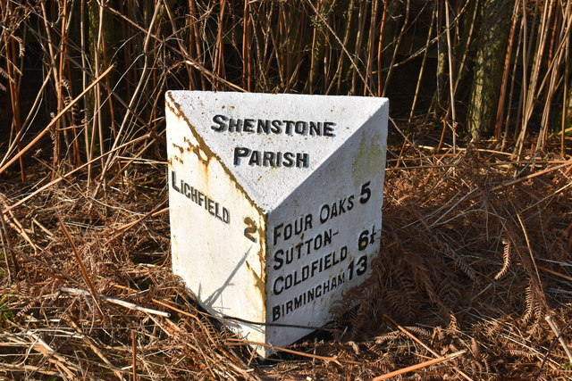
Image: © Martin Richard Phelan Taken: 7 Feb 2020
Standing beside the A5127 Birmingham Road towards Lichfield is this reminder of bygone days. Just beside the turning to the village of Wall - Letocetum Image - where there are Roman remains it speaks of the 1900s. The X3 Birmingham to Lichfield service which passes by, with modern buses, is operated by National Express West Midlands. Look to the south, to the Holiday Inn complex, and you are immediately pulled back to the 21st century. This stone reads 'SHENSTONE PARISH - LICHFIELD 2 - FOUR OAKS 5 SUTTON COLDFIELD 6 1/4 BIRMINGHAM 13. The link is a Milestones Society one, who are based in the South West, and their material is being transferred over to our Geograph website. Time photo taken 10.35 am GMT (Greenwich Mean Time). Image]
Images are licensed for reuse under creativecommons.org/licenses/by-sa/2.0
Image Location

Latitude
52.655482
Longitude
-1.834683