Edmund Street with old tram track, Birmingham
Introduction
The photograph on this page of Edmund Street with old tram track, Birmingham by P L Chadwick as part of the Geograph project.
The Geograph project started in 2005 with the aim of publishing, organising and preserving representative images for every square kilometre of Great Britain, Ireland and the Isle of Man.

There are currently over 7.5m images from over 14,400 individuals and you can help contribute to the project by visiting https://www.geograph.org.uk
Edmund Street with old tram track, Birmingham
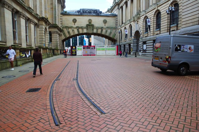
Image: © P L Chadwick Taken: 1 Sep 2019
A short length of history is preserved in this stretch of track from Birmingham's first generation tramway. The last three routes closed on the 4th July 1953. The block paving is modern. The system used the narrow gauge of 3 ft 6 inches (1067 mm). This was quite common in the past for Midlands systems, and for many small systems elsewhere. The Birmingham system was the most extensive narrow gauge system in the UK. At its maximum extent its route length was just over 80 miles (129 km approx.) The second generation tramway opened in 1999 using the national standard railway gauge and recently extended further into the city centre. Ambitious further extensions are due to open over the next few years.
Images are licensed for reuse under creativecommons.org/licenses/by-sa/2.0
Image Location
Latitude
52.480526
Longitude
-1.903659