Sarn Helen
Introduction
The photograph on this page of Sarn Helen by Alan Richards as part of the Geograph project.
The Geograph project started in 2005 with the aim of publishing, organising and preserving representative images for every square kilometre of Great Britain, Ireland and the Isle of Man.

There are currently over 7.5m images from over 14,400 individuals and you can help contribute to the project by visiting https://www.geograph.org.uk
Sarn Helen
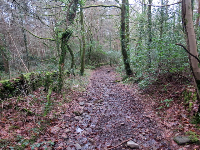
Image: © Alan Richards Taken: 3 Feb 2020
Heol Rufeinig a elwir Sarn Helen yn agosau at y B4242. Yn ystod misoedd y gaeaf ni chaniateir 4x4au na beiciau modur i deithio ar hyd-ddi oherwydd ei harwynebedd brau. A Roman Road known as Sarn Helen (trans. ?Helen's paved way) approaching the B4242. During the winter months 4x4s and motor cycles are prohibited from travelling along its length thereby reducing the risk of damaging this ancient thoroughfare.
Images are licensed for reuse under creativecommons.org/licenses/by-sa/2.0
Image Location
Latitude
51.686465
Longitude
-3.759426