The Green
Introduction
The photograph on this page of The Green by Ian Capper as part of the Geograph project.
The Geograph project started in 2005 with the aim of publishing, organising and preserving representative images for every square kilometre of Great Britain, Ireland and the Isle of Man.

There are currently over 7.5m images from over 14,400 individuals and you can help contribute to the project by visiting https://www.geograph.org.uk
The Green
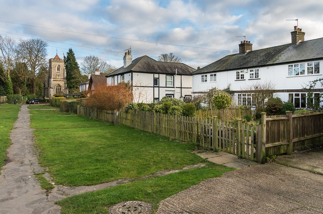
Image: © Ian Capper Taken: 10 Jan 2020
Buildings on The Green. On the right are Marion Cottages, first shown on the 1935 1:2,500 map. Beyond that is 4 - 5 The Green, a late 19th Century pair of semi-detached cottages, then St Peter's Church Hall, and then 1 - 2 another late 19th Century pair of semi-detached cottages. In the left background is St Peter's Church.
Images are licensed for reuse under creativecommons.org/licenses/by-sa/2.0
Image Location
Latitude
51.281826
Longitude
-0.248041