Wollaton village centre
Introduction
The photograph on this page of Wollaton village centre by Stephen Craven as part of the Geograph project.
The Geograph project started in 2005 with the aim of publishing, organising and preserving representative images for every square kilometre of Great Britain, Ireland and the Isle of Man.

There are currently over 7.5m images from over 14,400 individuals and you can help contribute to the project by visiting https://www.geograph.org.uk
Wollaton village centre
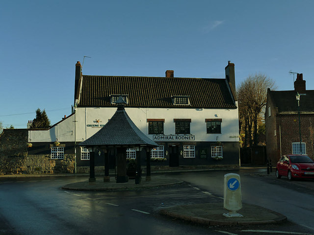
Image: © Stephen Craven Taken: 19 Jan 2020
At the centre of the village (which now forms part of the suburbs of Nottingham) are the old water pump (now under a wooden shelter), the Admiral Rodney pub, and (just out of shot to the right) St Leonard's church.
Images are licensed for reuse under creativecommons.org/licenses/by-sa/2.0
Image Location
Latitude
52.953203
Longitude
-1.220908