Fire damaged houses, Wear Bay Crescent
Introduction
The photograph on this page of Fire damaged houses, Wear Bay Crescent by John Baker as part of the Geograph project.
The Geograph project started in 2005 with the aim of publishing, organising and preserving representative images for every square kilometre of Great Britain, Ireland and the Isle of Man.

There are currently over 7.5m images from over 14,400 individuals and you can help contribute to the project by visiting https://www.geograph.org.uk
Fire damaged houses, Wear Bay Crescent
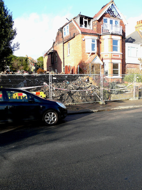
Image: © John Baker Taken: 12 Jan 2020
The fire started at 13:30 on 30 December 2019. The house that stood here was number 21 (but was so badly damaged that the remains were demolished) and the fire-damaged house, to its right, is number 23. This is number 19 of the Image https://www.kentonline.co.uk/folkestone/news/house-completely-demolished-after-huge-blaze-219419/
Images are licensed for reuse under creativecommons.org/licenses/by-sa/2.0
Image Location
Latitude
51.083914
Longitude
1.192488