Cirencester buildings [36]
Introduction
The photograph on this page of Cirencester buildings [36] by Michael Dibb as part of the Geograph project.
The Geograph project started in 2005 with the aim of publishing, organising and preserving representative images for every square kilometre of Great Britain, Ireland and the Isle of Man.

There are currently over 7.5m images from over 14,400 individuals and you can help contribute to the project by visiting https://www.geograph.org.uk
Cirencester buildings [36]
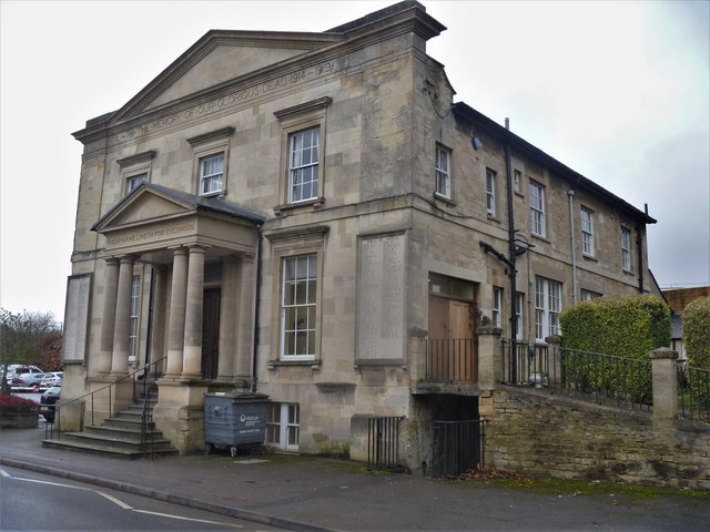
Image: © Michael Dibb Taken: 11 Dec 2019
Apsley Hall in Sheep Street has an interesting history. Built in 1833 as an Independent/Congregational chapel. Converted into a public hall in 1888, the memorial frontage was added circa 1919 and became part of Cirencester Memorial Hospital in 1923. In 1990 it became Cirencester Memorial Centre and currently houses two departments of the local NHS. Cirencester, the largest town in the Cotswolds, is a market town some 15 miles south east of Gloucester and some 13 miles north west of Swindon. The town lies on the River Churn, a tributary of the River Thames and is the hub of a network of roads. It is the home of the Royal Agricultural University, founded in 1840. An important Roman settlement known as Corinium, the town, with 240 acres enclosed by walls was second only to London in size.
Images are licensed for reuse under creativecommons.org/licenses/by-sa/2.0
Image Location
Latitude
51.715016
Longitude
-1.971438