WWII Dorset: discovering RAF Warmwell (35)
Introduction
The photograph on this page of WWII Dorset: discovering RAF Warmwell (35) by Mike Searle as part of the Geograph project.
The Geograph project started in 2005 with the aim of publishing, organising and preserving representative images for every square kilometre of Great Britain, Ireland and the Isle of Man.

There are currently over 7.5m images from over 14,400 individuals and you can help contribute to the project by visiting https://www.geograph.org.uk
WWII Dorset: discovering RAF Warmwell (35)
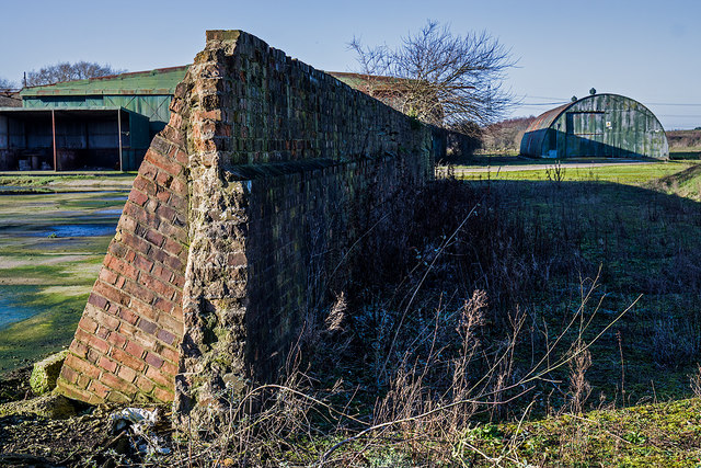
Image: © Mike Searle Taken: 19 Jan 2020
- Airfield - Bellman Hangar # 1 (site of) At one time on this site on the south side of the airfield there were two Bellman hangars, now just one of them remains, seen in the background alongside a Romney hut. Still standing is the brick-built blast wall that once protected the demolished hangar's north east side. As for the Romney hut, it is doubtful if it was ever part of RAF Warmwell, as it is not on the original 1946 site plan, and may have been placed here by the farmer post war. Image
Images are licensed for reuse under creativecommons.org/licenses/by-sa/2.0
Image Location


Leaflet Map data © OpenStreetMap
Latitude
50.69125
Longitude
-2.33731