Front Street, Monksilver, 1950
Introduction
The photograph on this page of Front Street, Monksilver, 1950 by David M Murray-Rust as part of the Geograph project.
The Geograph project started in 2005 with the aim of publishing, organising and preserving representative images for every square kilometre of Great Britain, Ireland and the Isle of Man.

There are currently over 7.5m images from over 14,400 individuals and you can help contribute to the project by visiting https://www.geograph.org.uk
Front Street, Monksilver, 1950
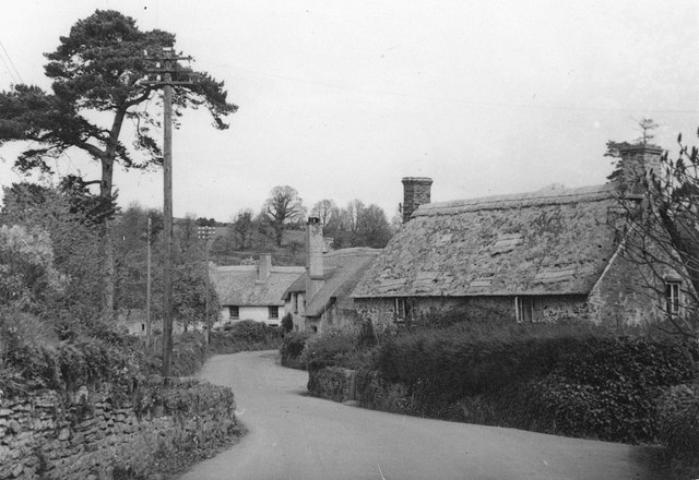
Image: © David M Murray-Rust Taken: 21 Apr 1950
It took a long time to identify the location of this view. The diary suggested that it would be in Monksilver, but a detailed search on streetview failed to provide a comparable view. Then looking at Geograph contributions, this view https://www.geograph.org.uk/photo/3414611suddenly looked right. The cottage on the right, and the more distant whitewashed one are clearly matches. The one in the centre no longer exists, and the two remaining ones have both had their thatched roofs replaced.
Images are licensed for reuse under creativecommons.org/licenses/by-sa/2.0
Image Location


Leaflet Map data © OpenStreetMap
Latitude
51.129786
Longitude
-3.326435