Cottages, Goveton
Introduction
The photograph on this page of Cottages, Goveton by Derek Harper as part of the Geograph project.
The Geograph project started in 2005 with the aim of publishing, organising and preserving representative images for every square kilometre of Great Britain, Ireland and the Isle of Man.

There are currently over 7.5m images from over 14,400 individuals and you can help contribute to the project by visiting https://www.geograph.org.uk
Cottages, Goveton
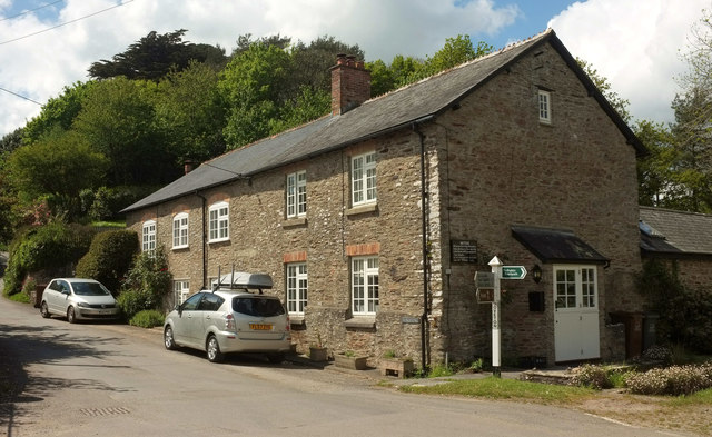
Image: © Derek Harper Taken: 9 May 2019
The left-hand part is the former village school. https://discovery.nationalarchives.gov.uk/details/r/2e792f50-65cf-4e61-84cc-861565401933 implies that the school was in operation between 1875 and 1926. The signpost and old sign on the wall shown in Image can be seen.
Images are licensed for reuse under creativecommons.org/licenses/by-sa/2.0
Image Location
Latitude
50.303989
Longitude
-3.751001