St Mary, Charlbury - south elevation
Introduction
The photograph on this page of St Mary, Charlbury - south elevation by David Kemp as part of the Geograph project.
The Geograph project started in 2005 with the aim of publishing, organising and preserving representative images for every square kilometre of Great Britain, Ireland and the Isle of Man.

There are currently over 7.5m images from over 14,400 individuals and you can help contribute to the project by visiting https://www.geograph.org.uk
St Mary, Charlbury - south elevation
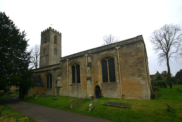
Image: © David Kemp Taken: 11 Jan 2020
The church is Norman in origin and was much enlarged in the C13. The windows seen here are of Perpendicular age and the battlemented bell-stage of the tower was added in the C15.
Images are licensed for reuse under creativecommons.org/licenses/by-sa/2.0
Image Location
Latitude
51.872135
Longitude
-1.484904