Ealing features [16]
Introduction
The photograph on this page of Ealing features [16] by Michael Dibb as part of the Geograph project.
The Geograph project started in 2005 with the aim of publishing, organising and preserving representative images for every square kilometre of Great Britain, Ireland and the Isle of Man.

There are currently over 7.5m images from over 14,400 individuals and you can help contribute to the project by visiting https://www.geograph.org.uk
Ealing features [16]
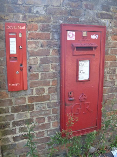
Image: © Michael Dibb Taken: 14 Sep 2019
A very rare surviving stamp machine alongside this King George V letter box. Situated in the wall of St Marys. Ealing is one of the seven major towns in the London Borough of Ealing. A rural village until communications with London got better with the improvements to the road to Oxford (later Uxbridge Road) in the 18th century and culminating with the coming of the railway in 1838. Ealing expanded greatly with suburban development during the 19th century and became known as the "Queen of the Suburbs" due to its greenery and because it was halfway between city and country. Ealing became a municipal borough in 1901. Growth continued throughout the 20th century and Ealing became part of a modern London borough in 1965.
Images are licensed for reuse under creativecommons.org/licenses/by-sa/2.0
Image Location


Leaflet Map data © OpenStreetMap
Latitude
51.509844
Longitude
-0.306376