Luggie Aqueduct and bridge from the northwest
Introduction
The photograph on this page of Luggie Aqueduct and bridge from the northwest by Richard Sutcliffe as part of the Geograph project.
The Geograph project started in 2005 with the aim of publishing, organising and preserving representative images for every square kilometre of Great Britain, Ireland and the Isle of Man.

There are currently over 7.5m images from over 14,400 individuals and you can help contribute to the project by visiting https://www.geograph.org.uk
Luggie Aqueduct and bridge from the northwest
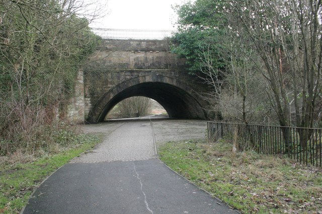
Image: © Richard Sutcliffe Taken: 15 Jan 2020
The aqueduct was built by John Smeaton between 1768 and 1775 to carry the Forth & Clyde Canal over the Luggie Water. The river was later culverted and a bridge built over the river below the aqueduct for the Campsie Branch railway, which opened in 1848, to cross over the river and under the canal at the same spot. The railway closed in 1966, and the bridge is now part of the walkway beside (and over) the Luggie Water. The structure is Category A listed http://portal.historicenvironment.scot/designation/LB36655, https://canmore.org.uk/site/168444/forth-and-clyde-canal-kirkintilloch-luggie-water-aqueduct.
Images are licensed for reuse under creativecommons.org/licenses/by-sa/2.0
Image Location
Latitude
55.939694
Longitude
-4.151388