St Andrew's community hall, Bruntcliffe, Morley - datestone
Introduction
The photograph on this page of St Andrew's community hall, Bruntcliffe, Morley - datestone by Stephen Craven as part of the Geograph project.
The Geograph project started in 2005 with the aim of publishing, organising and preserving representative images for every square kilometre of Great Britain, Ireland and the Isle of Man.

There are currently over 7.5m images from over 14,400 individuals and you can help contribute to the project by visiting https://www.geograph.org.uk
St Andrew's community hall, Bruntcliffe, Morley - datestone
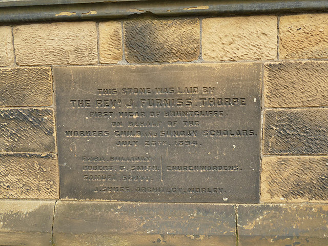
Image: © Stephen Craven Taken: 11 Jan 2020
The foundation stone is dated 28 July 1894, and records the fact that the hall was originally a Sunday School, and names the architect as J [probably Joseph] Sykes of Morley. See Image for context.
Images are licensed for reuse under creativecommons.org/licenses/by-sa/2.0
Image Location
Latitude
53.739668
Longitude
-1.61594