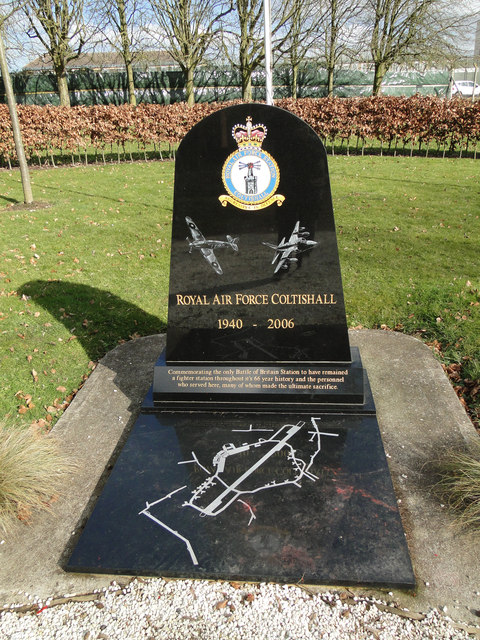
A memorial plaque to R.A.F. Coltishall
Introduction
The photograph on this page of A memorial plaque to R.A.F. Coltishall by Adrian S Pye as part of the Geograph project.
The Geograph project started in 2005 with the aim of publishing, organising and preserving representative images for every square kilometre of Great Britain, Ireland and the Isle of Man.
There are currently over 7.5m images from over 14,400 individuals and you can help contribute to the project by visiting https://www.geograph.org.uk

Image: © Adrian S Pye Taken: 27 Feb 2015
The stone remembers those that never returned as well as the uniqueness of RAF Coltishall in that from its inception until its closure it was always a fighter station. Work on RAF Coltishall was started in February 1939. The airfield, then known as Scottow Aerodrome and originally planned as a bomber airfield opened as a fighter airfield in the Second World War and afterwards, a station for night fighters then Strike Command aircraft until closure. During the Second World War, Coltishall operated the Hawker Hurricane, and a notable Coltishall fighter pilot was Douglas Bader. It later became home to night fighters. At the same time, the Royal Navy Fleet Air Arm operated aircraft from RAF Coltishall over the North Sea. From 10 February to 7 April 1945 it was the airfield for No. 124 Squadron RAF, at that time a fighter-bomber squadron flying Supermarine Spitfire IX.HF's. Postwar, the station was home to a variety of units and aircraft including de Havilland Mosquitoes, Gloster Javelins, English Electric Lightnings and - from 1963 - the "Historic Aircraft Flight" (now known as the Battle of Britain Memorial Flight). The last Lightnings left Coltishall in 1974, and were replaced by the Anglo-French SEPECAT Jaguar. The first Jaguar squadron, No. 54 Squadron RAF, arrived at Coltishall on 8 August 1974. Coltishall was also home to the yellow Search And Rescue (SAR) helicopters of 202 Sqn. Finally closed in 30 November 2006 and handed over to Defence Estates.

