WWII Dorset: discovering RAF Warmwell (12)
Introduction
The photograph on this page of WWII Dorset: discovering RAF Warmwell (12) by Mike Searle as part of the Geograph project.
The Geograph project started in 2005 with the aim of publishing, organising and preserving representative images for every square kilometre of Great Britain, Ireland and the Isle of Man.

There are currently over 7.5m images from over 14,400 individuals and you can help contribute to the project by visiting https://www.geograph.org.uk
WWII Dorset: discovering RAF Warmwell (12)
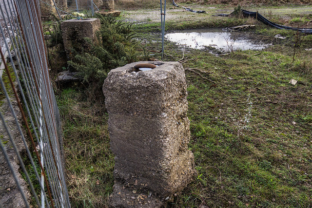
Image: © Mike Searle Taken: 10 Jan 2020
- The Airfield - Aircraft "tie downs" Here in the south east corner of the airfield are a number of concrete blocks that have been excavated by the developer of the land. These are aircraft "tie-down" anchors that were used to secure parked aircraft to minimise the possibility of untoward movement due to high winds or propeller wash. They would have originally been sunk into the ground at the dispersals below the aircraft, the tops of the anchoring points flush with the surface. Today, the site of the former airfield is either under development, or subject to extensive quarrying, the latter activity has unfortunately all but obliterated much of what used to remain. Image
Images are licensed for reuse under creativecommons.org/licenses/by-sa/2.0
Image Location
Latitude
50.692972
Longitude
-2.33265