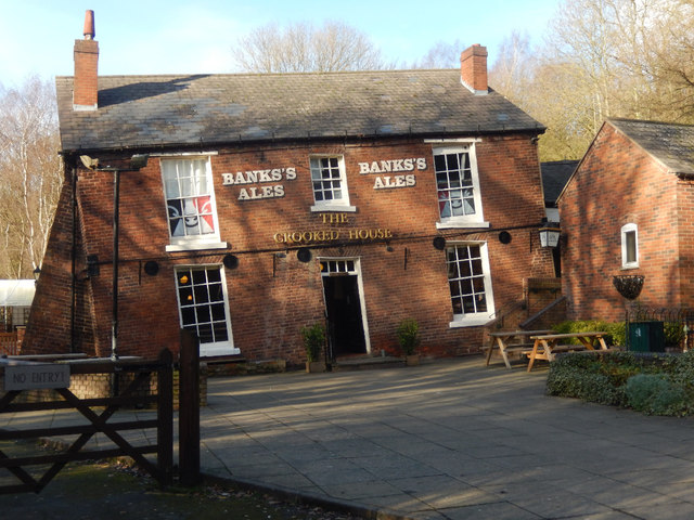
The Crooked House, Himley
Introduction
The photograph on this page of The Crooked House, Himley by Stephen McKay as part of the Geograph project.
The Geograph project started in 2005 with the aim of publishing, organising and preserving representative images for every square kilometre of Great Britain, Ireland and the Isle of Man.
There are currently over 7.5m images from over 14,400 individuals and you can help contribute to the project by visiting https://www.geograph.org.uk

Image: © Stephen McKay Taken: 10 Jan 2020
This pub is well-known, but nothing can quite prepare the visitor for their first sight of the extraordinary building. It is tucked away in a remote location surrounded by a landfill site at the end of a potholed lane - it would almost certainly have closed down many years ago had it not been for its unusual feature. Originally a farmhouse built in 1765, one side began to sink in the 19th century due to mining subsidence. It became a pub around 1830 and was for many years known as the Glynne Arms after a local landowner. Substantial buttresses and girders are now required to ensure the safety of the building while maintaining its crooked appearance. This image shows the pub in 1984 when it was still officially called the Glynne Arms: Image

