Wilmslow Road
Introduction
The photograph on this page of Wilmslow Road by Gerald England as part of the Geograph project.
The Geograph project started in 2005 with the aim of publishing, organising and preserving representative images for every square kilometre of Great Britain, Ireland and the Isle of Man.

There are currently over 7.5m images from over 14,400 individuals and you can help contribute to the project by visiting https://www.geograph.org.uk
Wilmslow Road
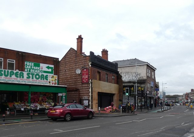
Image: © Gerald England Taken: 16 Nov 2019
The B5117 through Rusholme's "Curry Mile". The former Huntsman Inn Image on the right was originally a Hardy's Crown Brewery and later a Bass house. Reports suggest it was bit "rough" and it closed unexpectedly in 2011. Some restoration work appears to be now taking place.
Images are licensed for reuse under creativecommons.org/licenses/by-sa/2.0
Image Location
Latitude
53.452091
Longitude
-2.222822