A view across Barnstaple from North Road
Introduction
The photograph on this page of A view across Barnstaple from North Road by Roger A Smith as part of the Geograph project.
The Geograph project started in 2005 with the aim of publishing, organising and preserving representative images for every square kilometre of Great Britain, Ireland and the Isle of Man.

There are currently over 7.5m images from over 14,400 individuals and you can help contribute to the project by visiting https://www.geograph.org.uk
A view across Barnstaple from North Road
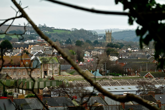
Image: © Roger A Smith Taken: 6 Jan 2020
The disused Small & Tidmas factory is in the foreground and the Holy Trinity Church clearly visible to the right of centre. The traffic lights in the centre of the image are at the junction of Alexandra Road and Bear Street.
Images are licensed for reuse under creativecommons.org/licenses/by-sa/2.0
Image Location


Leaflet Map data © OpenStreetMap
Latitude
51.081121
Longitude
-4.05474