Brintons Mills, The Sling, Kidderminster
Introduction
The photograph on this page of Brintons Mills, The Sling, Kidderminster by Chris Allen as part of the Geograph project.
The Geograph project started in 2005 with the aim of publishing, organising and preserving representative images for every square kilometre of Great Britain, Ireland and the Isle of Man.

There are currently over 7.5m images from over 14,400 individuals and you can help contribute to the project by visiting https://www.geograph.org.uk
Brintons Mills, The Sling, Kidderminster
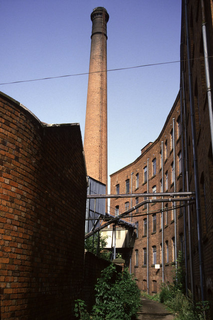
Image: © Chris Allen Taken: 16 Aug 1987
This little lane was called The Sling and is now largely covered by new development. The mill to the right with the impressive chimney has gone and there is a car park covering some of the area as the Weavers' Wharf. The preserved Slingfield Mills are to the left. The curved building on the right is a 5 storey warehouse, built 1867 and known as the "Piano Building" because the plan view resembles a grand piano (I've only learnt that fact very recently).
Images are licensed for reuse under creativecommons.org/licenses/by-sa/2.0
Image Location


Leaflet Map data © OpenStreetMap
Latitude
52.386258
Longitude
-2.252674