Flood mark on a garden wall, Brighouse
Introduction
The photograph on this page of Flood mark on a garden wall, Brighouse by Humphrey Bolton as part of the Geograph project.
The Geograph project started in 2005 with the aim of publishing, organising and preserving representative images for every square kilometre of Great Britain, Ireland and the Isle of Man.

There are currently over 7.5m images from over 14,400 individuals and you can help contribute to the project by visiting https://www.geograph.org.uk
Flood mark on a garden wall, Brighouse
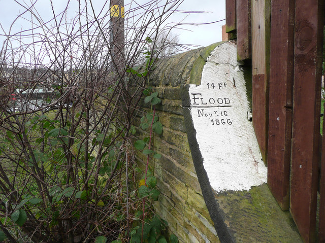
Image: © Humphrey Bolton Taken: 4 Jan 2020
Flooding in the Calder Valley has always been very frequent. The 1866 flood was "Recorded as the second highest flood after 1775." See https://eyeoncalderdale.com/history-of-flooding-in-Calderdale .
Images are licensed for reuse under creativecommons.org/licenses/by-sa/2.0
Image Location
Latitude
53.699627
Longitude
-1.775796