St Paul's Square
Introduction
The photograph on this page of St Paul's Square by Ian Capper as part of the Geograph project.
The Geograph project started in 2005 with the aim of publishing, organising and preserving representative images for every square kilometre of Great Britain, Ireland and the Isle of Man.

There are currently over 7.5m images from over 14,400 individuals and you can help contribute to the project by visiting https://www.geograph.org.uk
St Paul's Square
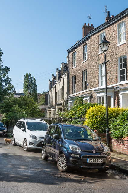
Image: © Ian Capper Taken: 17 Aug 2019
York's only "square", built c1855 and consisting of three storeyed terraced houses built in an elongated crescent surrounding a private central garden of lawn, shrubs and mature trees. Almost all the buildings are grade II listed. These houses are on the western arm of the crescent of the square: nearest on the right of the photo is no 33 - see www.historicengland.org.uk/listing/the-list/list-entry/1256749; and then no 34 - see www.historicengland.org.uk/listing/the-list/list-entry/1256750. The terrace beyond, nos 35 - 37 were a later addition, in the c1870s - see www.historicengland.org.uk/listing/the-list/list-entry/1256751.
Images are licensed for reuse under creativecommons.org/licenses/by-sa/2.0
Image Location
Latitude
53.955026
Longitude
-1.101628