Purton houses [9]
Introduction
The photograph on this page of Purton houses [9] by Michael Dibb as part of the Geograph project.
The Geograph project started in 2005 with the aim of publishing, organising and preserving representative images for every square kilometre of Great Britain, Ireland and the Isle of Man.

There are currently over 7.5m images from over 14,400 individuals and you can help contribute to the project by visiting https://www.geograph.org.uk
Purton houses [9]
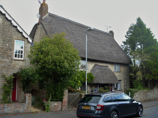
Image: © Michael Dibb Taken: 28 Aug 2019
Originally one house and later divided into two, Tudor Cottages at numbers 20 and 21 High Street are 16th or 17th century with later extensions. Liste, grade II, with details at: https://historicengland.org.uk/listing/the-list/list-entry/1023178 Originally built round the parish church, manor and Tithe barn, the village moved and is now mostly spread out along the Bristol and Oxford coach road.
Images are licensed for reuse under creativecommons.org/licenses/by-sa/2.0
Image Location
Latitude
51.586827
Longitude
-1.873225