Old Milestone by the A38 east of Bodmin
Introduction
The photograph on this page of Old Milestone by the A38 east of Bodmin by Rosy Hanns as part of the Geograph project.
The Geograph project started in 2005 with the aim of publishing, organising and preserving representative images for every square kilometre of Great Britain, Ireland and the Isle of Man.

There are currently over 7.5m images from over 14,400 individuals and you can help contribute to the project by visiting https://www.geograph.org.uk
Old Milestone by the A38 east of Bodmin
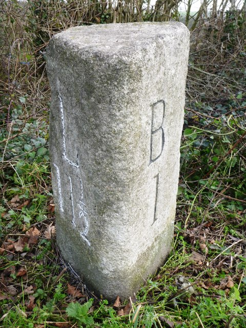
Image: © Rosy Hanns Taken: 22 Mar 2019
Carved stone post by the A38, in parish of BODMIN (NORTH CORNWALL District), Castle Canyke Farm, South of junction, Chy-Praze, 20m from toll house on brow of hill, by the road, on East side of road. 'BL' triangle, erected by the Bodmin turnpike trust in the 19th century. Inscription reads:- : L / 11½ : : B / 1 : Grade II listed. List Entry Number: 1393078 https://historicengland.org.uk/listing/the-list/list-entry/1393078 Milestone Society National ID: CW_BMLK01.
Images are licensed for reuse under creativecommons.org/licenses/by-sa/2.0
Image Location
Latitude
50.465061
Longitude
-4.697843