Old Guide Stone by the A389, Priory Road, Bodmin parish
Introduction
The photograph on this page of Old Guide Stone by the A389, Priory Road, Bodmin parish by Rosy Hanns as part of the Geograph project.
The Geograph project started in 2005 with the aim of publishing, organising and preserving representative images for every square kilometre of Great Britain, Ireland and the Isle of Man.

There are currently over 7.5m images from over 14,400 individuals and you can help contribute to the project by visiting https://www.geograph.org.uk
Old Guide Stone by the A389, Priory Road, Bodmin parish
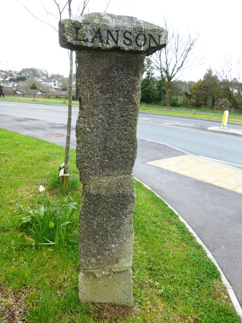
Image: © Rosy Hanns Taken: 22 Mar 2019
Stone post by the A389, in parish of Bodmin (North Cornwall District), East of town, where Launceston and Liskeard roads divide, between roads on grass verge. N.B. Stone has been moved further East from listed location due to roadworks. For earlier photo see: Image Inscription reads:- : LANSON : : LISKEARD : On shaft : TO STATION : Grade II listed. List Entry Number: 1024996 https://historicengland.org.uk/listing/the-list/list-entry/1024996 Surveyed Milestone Society National ID: CW_XBOD1
Images are licensed for reuse under creativecommons.org/licenses/by-sa/2.0
Image Location
Latitude
50.46896
Longitude
-4.711186