Old Milestone in Higher Penstroda
Introduction
The photograph on this page of Old Milestone in Higher Penstroda by Rosy Hanns as part of the Geograph project.
The Geograph project started in 2005 with the aim of publishing, organising and preserving representative images for every square kilometre of Great Britain, Ireland and the Isle of Man.

There are currently over 7.5m images from over 14,400 individuals and you can help contribute to the project by visiting https://www.geograph.org.uk
Old Milestone in Higher Penstroda
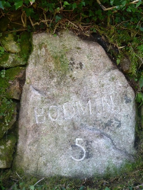
Image: © Rosy Hanns Taken: 28 Mar 2019
Milestone by the UC road, in parish of Blisland (North Cornwall District), opposite Higher Penstroda farmhouse, free moorstone built into wall. Inscription reads:- BODMIN 5 Cornwall & Scilly HER. HER Number: MCO64226 https://www.heritagegateway.org.uk/Gateway/Results_Single.aspx?uid=MCO64226&resourceID=1020 Surveyed Milestone Society National ID: CW_XBLIS
Images are licensed for reuse under creativecommons.org/licenses/by-sa/2.0
Image Location
Latitude
50.521134
Longitude
-4.65568