Finger Post at Crossroads, Warninglid, West Sussex.
Introduction
The photograph on this page of Finger Post at Crossroads, Warninglid, West Sussex. by Pete Chapman as part of the Geograph project.
The Geograph project started in 2005 with the aim of publishing, organising and preserving representative images for every square kilometre of Great Britain, Ireland and the Isle of Man.

There are currently over 7.5m images from over 14,400 individuals and you can help contribute to the project by visiting https://www.geograph.org.uk
Finger Post at Crossroads, Warninglid, West Sussex.
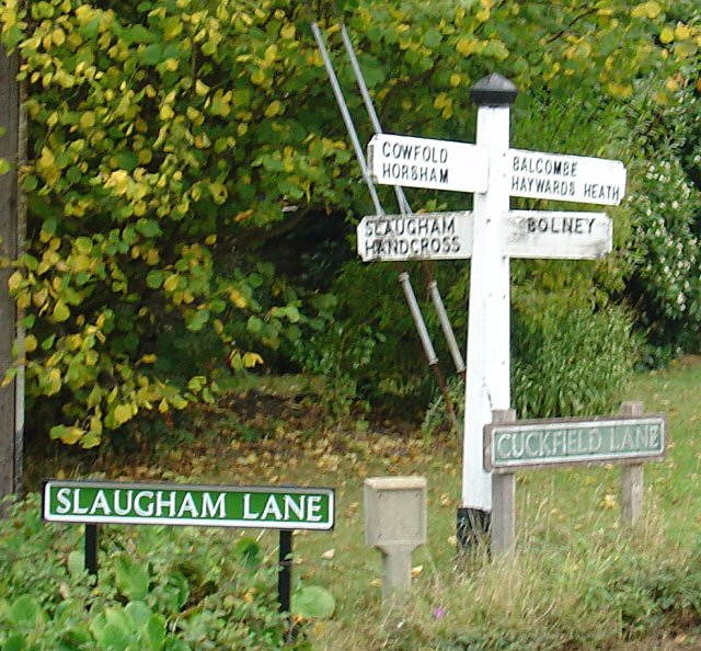
Image: © Pete Chapman Taken: 8 Oct 2005
N Direction (Slaugham Lane): Slaugham; and Handcross. S Direction: Bolney. E Direction (Cuckfield Lane): Balcombe; and Haywards Heath (via Cuckfield). W Direction: Cowfold; and Horsham.
Images are licensed for reuse under creativecommons.org/licenses/by-sa/2.0
Image Location


Leaflet Map data © OpenStreetMap
Latitude
51.020695
Longitude
-0.219176