Clearing up flooding on M23
Introduction
The photograph on this page of Clearing up flooding on M23 by Robin Webster as part of the Geograph project.
The Geograph project started in 2005 with the aim of publishing, organising and preserving representative images for every square kilometre of Great Britain, Ireland and the Isle of Man.

There are currently over 7.5m images from over 14,400 individuals and you can help contribute to the project by visiting https://www.geograph.org.uk
Clearing up flooding on M23
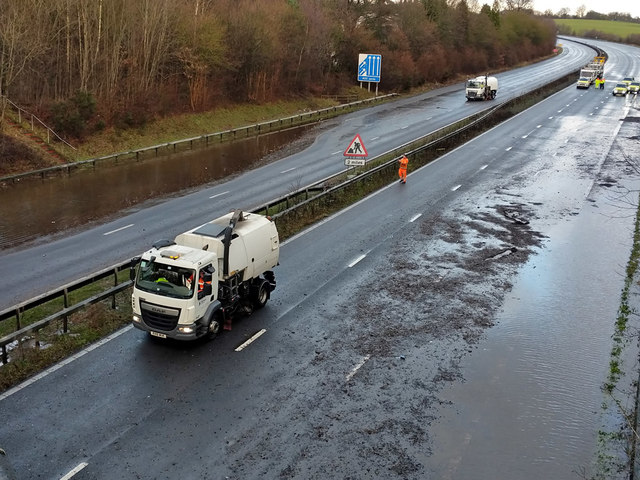
Image: © Robin Webster Taken: 20 Dec 2019
At its peak both carriageways were totally flooded, but I wasn't aware of what was going on then. The pool on the left was yet to be drained, men were probing trying to find a drain cover, when they succeeded and removed the cover the water started draining quite well. This is viewed from the B2036 Balcombe Road bridge. The problem appeared to be some sort of blockage or under capacity of the culvert taking a stream under the road, earlier photographs show water pouring down from the right from between the main road and the junction 11a slip road.
Images are licensed for reuse under creativecommons.org/licenses/by-sa/2.0
Image Location
Latitude
51.103896
Longitude
-0.144988