Southfield Road
Introduction
The photograph on this page of Southfield Road by Mick Garratt as part of the Geograph project.
The Geograph project started in 2005 with the aim of publishing, organising and preserving representative images for every square kilometre of Great Britain, Ireland and the Isle of Man.

There are currently over 7.5m images from over 14,400 individuals and you can help contribute to the project by visiting https://www.geograph.org.uk
Southfield Road
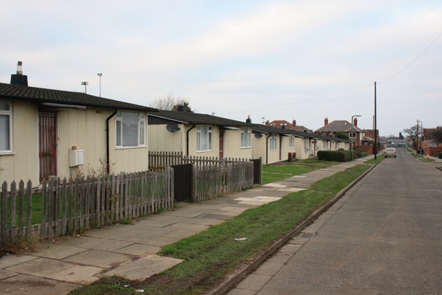
Image: © Mick Garratt Taken: 16 Dec 2007
Prefabricated houses, built as emergency accommodation in 1947 for troops returning from the Second World War. This were labelled as "Homes for Heroes" and expected to have a life expectancy of just ten years. Fifty years on and the replacement homes are finally being provided. These are due for demolition in the next phase.
Images are licensed for reuse under creativecommons.org/licenses/by-sa/2.0
Image Location
Latitude
54.590085
Longitude
-1.015596