17th Century Gables, Godalming
Introduction
The photograph on this page of 17th Century Gables, Godalming by Colin Smith as part of the Geograph project.
The Geograph project started in 2005 with the aim of publishing, organising and preserving representative images for every square kilometre of Great Britain, Ireland and the Isle of Man.

There are currently over 7.5m images from over 14,400 individuals and you can help contribute to the project by visiting https://www.geograph.org.uk
17th Century Gables, Godalming
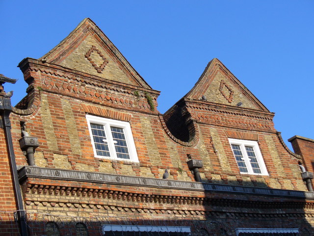
Image: © Colin Smith Taken: 16 Dec 2007
Above WH Smith are these brick and bargate stone Dutch-style gables. These used to be two private houses.
Images are licensed for reuse under creativecommons.org/licenses/by-sa/2.0
Image Location


Leaflet Map data © OpenStreetMap
Latitude
51.185409
Longitude
-0.615206