Old milestone in Munlochy
Introduction
The photograph on this page of Old milestone in Munlochy by Julian Paren as part of the Geograph project.
The Geograph project started in 2005 with the aim of publishing, organising and preserving representative images for every square kilometre of Great Britain, Ireland and the Isle of Man.

There are currently over 7.5m images from over 14,400 individuals and you can help contribute to the project by visiting https://www.geograph.org.uk
Old milestone in Munlochy
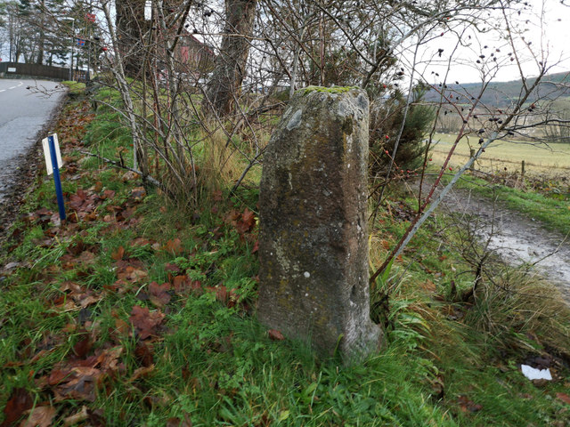
Image: © Julian Paren Taken: 12 Dec 2019
Today the stone seems to be without any inscription. The original 6 inch OS map has the information associated with the location "Kessock Ferry 5 miles, Fortrose 5 miles". The stone lies by the junction between the main road and the direct path to the village hall (seen in the background) from the centre of the village. The stone is of similar form to the one on the approach to the village from North Kessock. Image] The Milestone Society has also contributed an image of this stone which alerted me to its presence. Image] Surveyed Milestone Society National ID: HI_MNIV00
Images are licensed for reuse under creativecommons.org/licenses/by-sa/2.0
Image Location
Latitude
57.549537
Longitude
-4.260498