Milestone near Monk Fryston
Introduction
The photograph on this page of Milestone near Monk Fryston by Alan Murray-Rust as part of the Geograph project.
The Geograph project started in 2005 with the aim of publishing, organising and preserving representative images for every square kilometre of Great Britain, Ireland and the Isle of Man.

There are currently over 7.5m images from over 14,400 individuals and you can help contribute to the project by visiting https://www.geograph.org.uk
Milestone near Monk Fryston
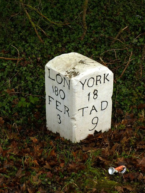
Image: © Alan Murray-Rust Taken: 8 Dec 2019
A survivor from the earlier, 18th century, set of milestones on the Ferrybridge to Tadcaster road, replaced in the 19th century by cast iron milestones at different locations, see http://www.geograph.org.uk/photo/6341877 . See http://www.geograph.org.uk/photo/6341880 for location.
Images are licensed for reuse under creativecommons.org/licenses/by-sa/2.0
Image Location
Latitude
53.755931
Longitude
-1.252698