The Hollow
Introduction
The photograph on this page of The Hollow by Derek Harper as part of the Geograph project.
The Geograph project started in 2005 with the aim of publishing, organising and preserving representative images for every square kilometre of Great Britain, Ireland and the Isle of Man.

There are currently over 7.5m images from over 14,400 individuals and you can help contribute to the project by visiting https://www.geograph.org.uk
The Hollow
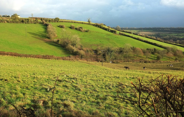
Image: © Derek Harper Taken: 6 Dec 2019
In the midst of a spell of sunshine that lasted a whole eight minutes, followed by weather more appropriate to the clouds in the background for the rest of the day. The Hollow is a cleft-like combe dropping from Longhouse to the Cam Brook valley at Dunkerton, and this is an upper portion, seen from Withyditch Lane.
Images are licensed for reuse under creativecommons.org/licenses/by-sa/2.0
Image Location
Latitude
51.337614
Longitude
-2.420272