United Methodist Free Church, Carlingcott
Introduction
The photograph on this page of United Methodist Free Church, Carlingcott by Derek Harper as part of the Geograph project.
The Geograph project started in 2005 with the aim of publishing, organising and preserving representative images for every square kilometre of Great Britain, Ireland and the Isle of Man.

There are currently over 7.5m images from over 14,400 individuals and you can help contribute to the project by visiting https://www.geograph.org.uk
United Methodist Free Church, Carlingcott
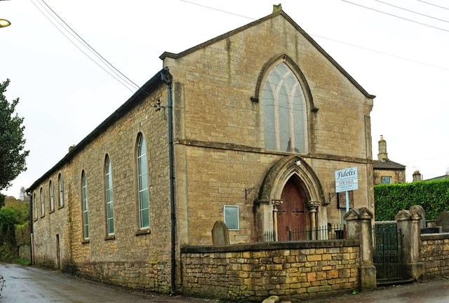
Image: © Derek Harper Taken: 6 Dec 2019
"Chapel and schoolroom. Dated 1851" begins the listed building description https://historicengland.org.uk/listing/the-list/list-entry/1129506 . The walls and gates at the front form part of the listing. Now for sale, as you can see, although the agent seems to think it dates from 1869. However, I can confirm that the date on the "thin pointed porch on colonettes with leaf capitals" is 1851. On the left is Firgrove Lane, heading to Peasedown St John.
Images are licensed for reuse under creativecommons.org/licenses/by-sa/2.0
Image Location
Latitude
51.322004
Longitude
-2.435197