Waterloo Mill, Cobnash
Introduction
The photograph on this page of Waterloo Mill, Cobnash by Philip Pankhurst as part of the Geograph project.
The Geograph project started in 2005 with the aim of publishing, organising and preserving representative images for every square kilometre of Great Britain, Ireland and the Isle of Man.

There are currently over 7.5m images from over 14,400 individuals and you can help contribute to the project by visiting https://www.geograph.org.uk
Waterloo Mill, Cobnash
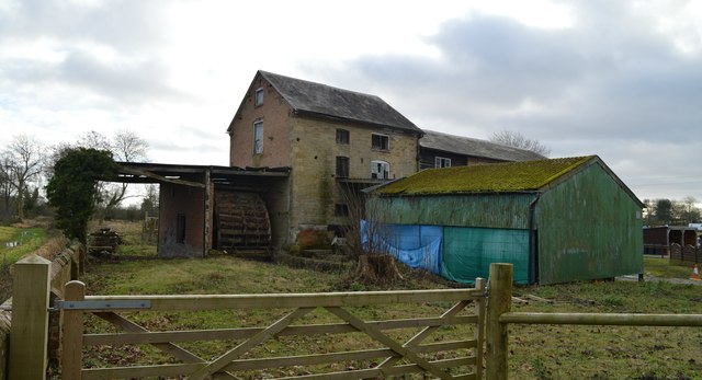
Image: © Philip Pankhurst Taken: 7 Dec 2019
'Waterloo Mill was built as a water-powered corn mill in 1861, replacing an earlier corn mill which stood to the south-west. It was equipped with an undershot waterwheel and an all-iron layshaft gearing system installed by the millwright Richard Miles of Leominster. There is, however, uncertainty as to whether the entire mill complex, which additionally consists of a second mill building (possibly a storehouse) standing to the south-west of the corn mill, a wheel house, a mill house and a range of outbuildings, were constructed at the same time. The entire mill complex is, however, recorded on the first edition Ordnance Survey map of 1887. Furthermore, evidence from the building fabric of the corn mill also suggests that it was either built re-using some of the building material from the earlier mill or that it was either heightened or re-built to some extent between 1861 and 1887. The second edition Ordnance Survey map of 1903 still records the building as being a corn mill but by 1928, when the third edition Ordnance Survey Map was published, it had changed use to a cider mill. In the second half of the C20 the mill closed and the building were used as a livestock farm. In the late-C20 a cart-shed and cattle-shed were added to the site and in the early-C21 the two principal mill buildings were re-slated.' Historic England Listing details - GII listing.
Images are licensed for reuse under creativecommons.org/licenses/by-sa/2.0
Image Location
Latitude
52.240297
Longitude
-2.80527