Chester, Steam Mill
Introduction
The photograph on this page of Chester, Steam Mill by Mike Faherty as part of the Geograph project.
The Geograph project started in 2005 with the aim of publishing, organising and preserving representative images for every square kilometre of Great Britain, Ireland and the Isle of Man.

There are currently over 7.5m images from over 14,400 individuals and you can help contribute to the project by visiting https://www.geograph.org.uk
Chester, Steam Mill
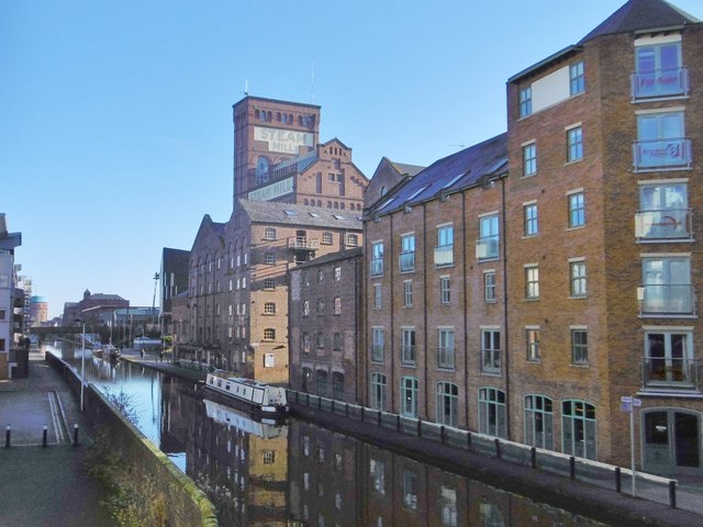
Image: © Mike Faherty Taken: 3 Dec 2019
Former steam-powered corn mill, overlooking Shropshire Union Canal. The building dates from late C18, and is Grade II listed by Historic England: https://historicengland.org.uk/listing/the-list/list-entry/1375938
Images are licensed for reuse under creativecommons.org/licenses/by-sa/2.0
Image Location


Leaflet Map data © OpenStreetMap
Latitude
53.193407
Longitude
-2.880349