Beeding Bridge
Introduction
The photograph on this page of Beeding Bridge by Simon Carey as part of the Geograph project.
The Geograph project started in 2005 with the aim of publishing, organising and preserving representative images for every square kilometre of Great Britain, Ireland and the Isle of Man.

There are currently over 7.5m images from over 14,400 individuals and you can help contribute to the project by visiting https://www.geograph.org.uk
Beeding Bridge
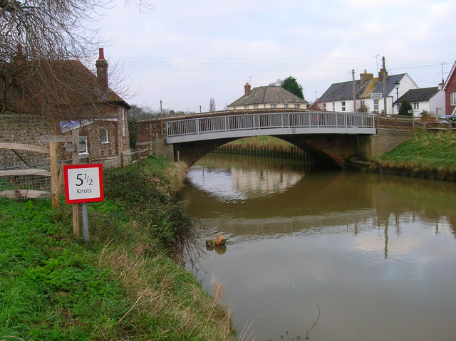
Image: © Simon Carey Taken: 15 Dec 2007
There were originally two bridges crossing the Adur at this point; Bramber Bridge was originally the more important crossing another arm of the river to the west and being 170 foot long stone bridge with a small chapel in the middle; and the lesser Beeding Bridge built of wood crossed the eastern arm of the river. The former's importance shrank as the western arm silted up and was eventually buried around the 17th century. The latter's importance increased and the wooden structure was replaced with a brick one in 1785. The iron footbridge was added in 1926 as the narrow bridge originally carried the A283 over the river until a by-pass was built to the south in the mid 1980s. Beeding Bridge also marks the boundary between Bramber to the left and Upper Beeding to the right.
Images are licensed for reuse under creativecommons.org/licenses/by-sa/2.0
Image Location
Latitude
50.882783
Longitude
-0.306752