Tiverton : Tidcombe Hall
Introduction
The photograph on this page of Tiverton : Tidcombe Hall by Lewis Clarke as part of the Geograph project.
The Geograph project started in 2005 with the aim of publishing, organising and preserving representative images for every square kilometre of Great Britain, Ireland and the Isle of Man.

There are currently over 7.5m images from over 14,400 individuals and you can help contribute to the project by visiting https://www.geograph.org.uk
Tiverton : Tidcombe Hall
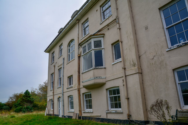
Image: © Lewis Clarke Taken: 29 Oct 2019
Early 19th century house, shown as Tidcombe Rectory on late 19th century Ordnance Survey map. Much altered in late 20th century. The building was also once a Marie Curie daycare unit and today it's earmarked for redevelopment.
Images are licensed for reuse under creativecommons.org/licenses/by-sa/2.0
Image Location


Leaflet Map data © OpenStreetMap
Latitude
50.90014
Longitude
-3.459691