Rentwood
Introduction
The photograph on this page of Rentwood by Ian Capper as part of the Geograph project.
The Geograph project started in 2005 with the aim of publishing, organising and preserving representative images for every square kilometre of Great Britain, Ireland and the Isle of Man.

There are currently over 7.5m images from over 14,400 individuals and you can help contribute to the project by visiting https://www.geograph.org.uk
Rentwood
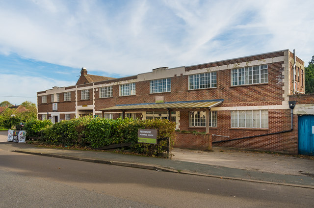
Image: © Ian Capper Taken: 30 Oct 2019
Building in School Lane, providing support services for the visually impaired and hard of hearing, through the charity Sight for Surrey, and also housing a resource centre for Surrey County Council care services. It was originally built as a dance hall, but was subsequently occupied by the wood treatment firm Rentokil until a fire in 1963 in adjacent storage tanks led their leaving the site, which was then sold to Surrey County Council the following year.
Images are licensed for reuse under creativecommons.org/licenses/by-sa/2.0
Image Location


Leaflet Map data © OpenStreetMap
Latitude
51.291546
Longitude
-0.353904