Silverdale Railway Tunnel East Side (Disused)
Introduction
The photograph on this page of Silverdale Railway Tunnel East Side (Disused) by Brian Deegan as part of the Geograph project.
The Geograph project started in 2005 with the aim of publishing, organising and preserving representative images for every square kilometre of Great Britain, Ireland and the Isle of Man.

There are currently over 7.5m images from over 14,400 individuals and you can help contribute to the project by visiting https://www.geograph.org.uk
Silverdale Railway Tunnel East Side (Disused)
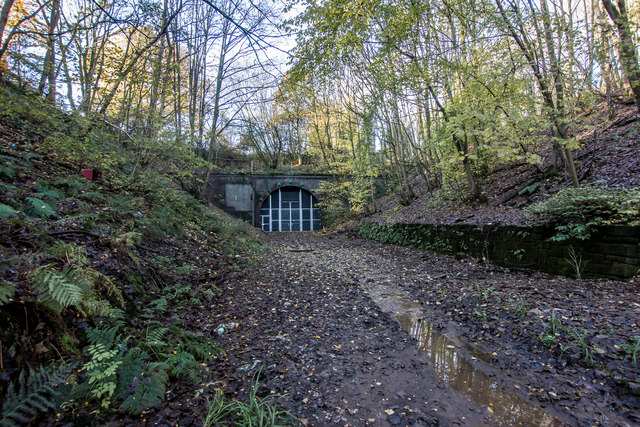
Image: © Brian Deegan Taken: 10 Nov 2019
Built around 1863 and is 68 Yards long and is on the old Stoke to Market Drayton line. Closed in 1998. The Tracks are still in place in the tunnel, and on the west side of the tunnel heading out to Madeley and Keele https://www.geograph.org.uk/photo/6096882 https://en.wikipedia.org/wiki/Stoke_to_Market_Drayton_Line
Images are licensed for reuse under creativecommons.org/licenses/by-sa/2.0
Image Location
Latitude
53.015196
Longitude
-2.282868