The Barn
Introduction
The photograph on this page of The Barn by Ian Capper as part of the Geograph project.
The Geograph project started in 2005 with the aim of publishing, organising and preserving representative images for every square kilometre of Great Britain, Ireland and the Isle of Man.

There are currently over 7.5m images from over 14,400 individuals and you can help contribute to the project by visiting https://www.geograph.org.uk
The Barn
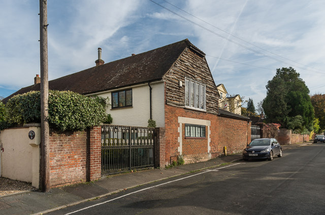
Image: © Ian Capper Taken: 30 Oct 2019
Late 17th century building, with the brick section by the road being a cottage acting as a lodge to Ballands Hall (the house in the background). Next to it were stables and a barn, which have since been joined up as a single building.
Images are licensed for reuse under creativecommons.org/licenses/by-sa/2.0
Image Location
Latitude
51.290435
Longitude
-0.353585