Cut benchmark
Introduction
The photograph on this page of Cut benchmark by Tiger as part of the Geograph project.
The Geograph project started in 2005 with the aim of publishing, organising and preserving representative images for every square kilometre of Great Britain, Ireland and the Isle of Man.

There are currently over 7.5m images from over 14,400 individuals and you can help contribute to the project by visiting https://www.geograph.org.uk
Cut benchmark
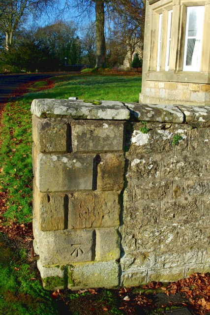
Image: © Tiger Taken: 30 Nov 2019
On the right-hand pier at the Image, this cut mark is not on the Benchmark database but was recorded by the Ordnance Survey in 1967 as being 153.268m above sea level at Newlyn datum and 400mm above ground level. For other benchmarks in the village see Michael Rye's Image and Adrian Dust's Image
Images are licensed for reuse under creativecommons.org/licenses/by-sa/2.0
Image Location
Latitude
55.231444
Longitude
-2.177168