Lissanduff Earthworks, Portballintrae
Introduction
The photograph on this page of Lissanduff Earthworks, Portballintrae by Colin Park as part of the Geograph project.
The Geograph project started in 2005 with the aim of publishing, organising and preserving representative images for every square kilometre of Great Britain, Ireland and the Isle of Man.

There are currently over 7.5m images from over 14,400 individuals and you can help contribute to the project by visiting https://www.geograph.org.uk
Lissanduff Earthworks, Portballintrae
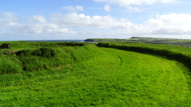
Image: © Colin Park Taken: 13 Jun 2019
This site consists of two concentric earthen circles with a mound in the middle and often known as a ‘cup and saucer’. The earthworks date from the Bronze Age and the saucer was clay lined to form a circular lake and a source of water.
Images are licensed for reuse under creativecommons.org/licenses/by-sa/2.0
Image Location
Latitude
55.218708
Longitude
-6.538905