Deptford Creek at low tide
Introduction
The photograph on this page of Deptford Creek at low tide by Stephen Craven as part of the Geograph project.
The Geograph project started in 2005 with the aim of publishing, organising and preserving representative images for every square kilometre of Great Britain, Ireland and the Isle of Man.

There are currently over 7.5m images from over 14,400 individuals and you can help contribute to the project by visiting https://www.geograph.org.uk
Deptford Creek at low tide
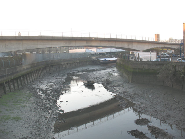
Image: © Stephen Craven Taken: 12 Dec 2007
The creek is the tidal stretch of the otherwise insignificant rivers Ravensbourne and Quaggy which come together a little further upstream in Lewisham. This view is taken from the same footbridge as Image but looking in the opposite direction at low tide with only the river flow in the bottom of the creek.
Images are licensed for reuse under creativecommons.org/licenses/by-sa/2.0
Image Location
Latitude
51.477472
Longitude
-0.019417