Ferry House, Ardentinny
Introduction
The photograph on this page of Ferry House, Ardentinny by Thomas Nugent as part of the Geograph project.
The Geograph project started in 2005 with the aim of publishing, organising and preserving representative images for every square kilometre of Great Britain, Ireland and the Isle of Man.

There are currently over 7.5m images from over 14,400 individuals and you can help contribute to the project by visiting https://www.geograph.org.uk
Ferry House, Ardentinny
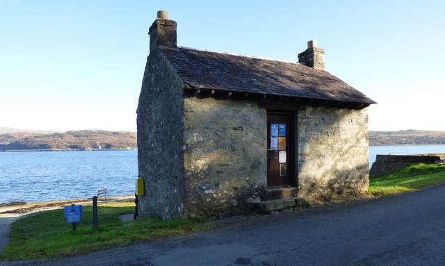
Image: © Thomas Nugent Taken: 8 Nov 2019
This small building from the early 1800s is a remnant of the long ceased Ardentinny to Coulport ferry service. It is now used by the adjacent outdoor education centre. Category C Listed http://portal.historicenvironment.scot/designation/LB50404 .
Images are licensed for reuse under creativecommons.org/licenses/by-sa/2.0
Image Location


Leaflet Map data © OpenStreetMap
Latitude
56.045735
Longitude
-4.909461