
Works in Woodcote Road to the north of Warwick station
Introduction
The photograph on this page of Works in Woodcote Road to the north of Warwick station by Robin Stott as part of the Geograph project.
The Geograph project started in 2005 with the aim of publishing, organising and preserving representative images for every square kilometre of Great Britain, Ireland and the Isle of Man.

There are currently over 7.5m images from over 14,400 individuals and you can help contribute to the project by visiting https://www.geograph.org.uk
Works in Woodcote Road to the north of Warwick station
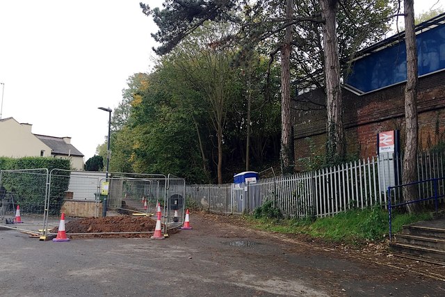
Image: © Robin Stott Taken: 30 Oct 2019
Warwick station is on an embankment. The only access to the eastbound/north platform is a long flight of steps. Decades ago there was a footpath ramp, now destroyed by tree seedlings. According to the local paper a longstanding proposal for a passenger lift has been approved. The hole in the road is a sign of enabling works. The County Council, Network Rail, and local residents estimate different times for the lift's completion.
Images are licensed for reuse under creativecommons.org/licenses/by-sa/2.0
Image Location

Latitude
52.286808
Longitude
-1.581852