Upper Lake and immediate grounds, Gravetye Manor
Introduction
The photograph on this page of Upper Lake and immediate grounds, Gravetye Manor by Robin Webster as part of the Geograph project.
The Geograph project started in 2005 with the aim of publishing, organising and preserving representative images for every square kilometre of Great Britain, Ireland and the Isle of Man.

There are currently over 7.5m images from over 14,400 individuals and you can help contribute to the project by visiting https://www.geograph.org.uk
Upper Lake and immediate grounds, Gravetye Manor
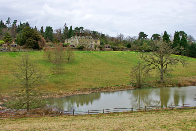
Image: © Robin Webster Taken: 27 Mar 2010
The manor beyond was built in its original form in the late 16th century for an ironmaster. The lake was created, apparently from scratch, by a later owner in Victorian times along with the gardens. The Lower Lake, out of sight to the right, was restored from an old hammer pond. Another hammer pond, now drained, was off to the left.
Images are licensed for reuse under creativecommons.org/licenses/by-sa/2.0
Image Location
Latitude
51.088082
Longitude
-0.057231